
AmericaView advances Earth observation education through remote sensing science, applied research, workforce development, technology transfer, and community outreach.
-- Incorporated 2003
Education & Outreach
Energize Earth Observation Education and Outreach
- Develop experiential learning activities, games, demonstrations, and art displays designed to enhance geospatial literacy.
- Engage with K-12 teachers to develop and maintain standards-based educational materials and activities that link STEAM disciplines to community needs and issues.
- Provide higher education students with an open, inclusive, and collaborative environment within internships, service learning programs, research opportunities, and interdisciplinary group projects.
- Train the current workforce in industry, government, and academia using new data, products, tools, and methods.
- Reach audiences through informal education to promote the awareness and importance of Earth observation in society.
Strategic Partnerships
Expand Local, National, and International Strategic Partnerships
- Expand its national program by identifying opportunities that sustain and expand the consortium.
- Foster the development of educational resources that support Earth observation education, are freely available, and provide a foundational resource for the use of EO information and data to improve our world.
- Establish strategic partnerships by identifying EO needs and opportunities in the public, private, and educational sectors.
- Expand its reach by establishing strategic partnerships through a focus on disaster and emergency response and workforce development.
- Expand working partnerships within and between StateView programs.
Research
Strengthen Applied Remote Sensing Research
- Augment EO research to address local to global geospatial information needs.
- Secure funding from a variety of sources for sustaining and expanding applied remote sensing research at local to global scales.
- Promote the awareness and applications of new and operational sensors, platforms, data characteristics, and their use in EO.
- Expand innovative use of EO data, products and analytics by mobilizing the AV network.
- Disseminate research methods and results through various publication formats and data portals that convey remote sensing procedures, best practices, and workflow recipes.
National Recognition
Serve as a Recognized National Remote Sensing Resource
- Collaborate broadly with related organizations on research, outreach, and education to advance EO concepts and capabilities.
- Champion AmericaView expertise in word and action.
- Articulate the unique identity of AmericaView and its StateViews.
- Continuously review and renew AV resources for relevance to the EO community.
- Capture the imagination of the public and educate all communities.
AmericaView's Successes
-
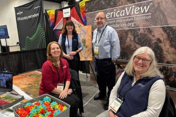
AmericaView Promotes Earth Observation Education at Geo Week 2025
Continue readingThe AmericaView team traveled to Denver, Colorado to attend Geo Week from February 10-12, 2025. Geo Week provides programming in the geospatial and built worlds through multiple partner organizations coming together for the event. In 2025, the American Society for Photogrammetry and Remote Sensing and the Reality Capture Network partnered with Geo Week to bring […]
-
AmericaView Supports NSF Funded Spatial Literacy Workshop
Continue readingThree AmericaView states, Ohio, Louisiana, and Idaho, collaborated with NSF to host an interactive spatial literacy workshop for undergraduate and graduate students, and members of the workforce. This has been a three-year project, with the first year (2022) hosted in Ohio at Bowling Green State University, the second year (2023) was hosted in Louisiana, at […]
-
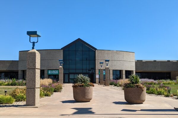
AmericaView Awarded Five Year USGS National Land Imaging Agreement
Continue readingAmericaView is pleased to announce that the United States Geological Survey (USGS) National Land Imaging (NLI) Program has awarded the next competitive five-year agreement of the National Land Remote Sensing Education, Outreach and Research Activity (NLRSEORA) grant to AmericaView. This prestigious grant underscores the sustained commitment and collaboration between the USGS and AmericaView toward advancing […]
-
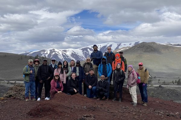
AmericaView Supports USGS EROS in Celebrating 50 Years of Science and Discovery
Continue readingAmericaView Hosts STEM Event at the USGS EROS Center To commemorate the 50th anniversary of the Earth Resources Observation and Science (EROS) Center, AmericaView was enlisted by the U.S. Geological Survey (USGS) to collaborate with the National Land Imaging team and EROS staff. The three-day celebration featured a series of events, including a ribbon-cutting ceremony, […]