
-
AmericaView Hosts STEM Event at the 2022 William T. Pecora Symposium in Denver
Continue readingOn October 25th, 2022, AmericaView hosted a STEM event to coincide with the 2022 USgS William T. Pecora Symposium in Denver, Colorado. This event was organized by AmericaView staff and a subset of the AmericaView Education and Outreach Committee. Funded by the USGS National Land Imaging (NLI) Program National Land Remote Sensing Education, Outreach, and […]
-
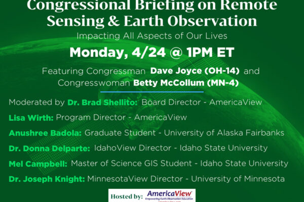
AmericaView Hosts Congressional Briefing on the Importance of Remote Sensing and Earth Observation Education
Continue readingOn Monday, April 24th, 2023, AmericaView, in collaboration with G2G Consulting, hosted a virtual Congressional Briefing on the importance of remote sensing (RS) and Earth observation (EO) education. More than 100 individuals registered for the event and more than 80 attended. The briefing was recorded and will be made available. Briefing topics included the background […]
-
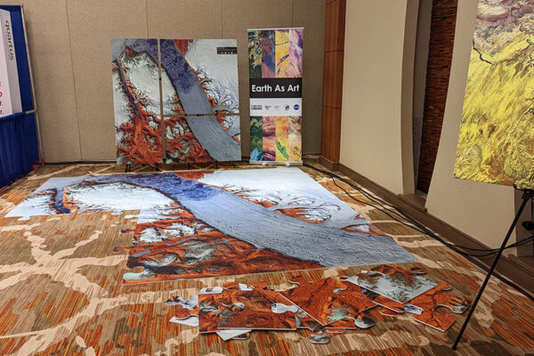
AmericaView Supports USGS National Land Imaging Program and NASA in Navajo Nation STEM Activity
Continue readingAmericaView members traveled to Window Rock, Arizona, the capital of the Navajo Nation, to support a community-wide Science, Technology, Engineering, and Mathematics (STEM) event. The event, Nihimá Nahasdzáán – The Art of Mother Earth Gallery Event – was held at the Navajo Nation museum and featured a number of interactive remote sensing and Earth observation […]
-
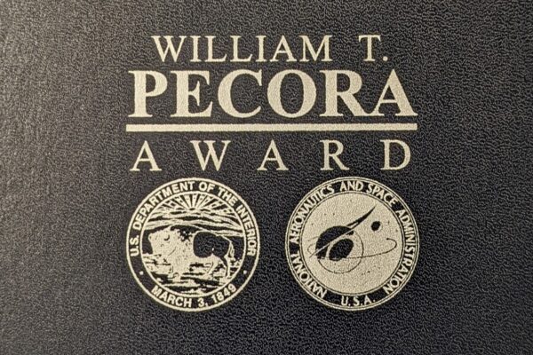
AmericaView Receives the Department of Interior and NASA William T. Pecora Group Award
Continue readingThe William T. Pecora Award, established in honor of Dr. William T. Pecora, former Director of the U.S. Geological Survey and early visionary of using remote sensing of earth from space, is an annual award presented to individuals and teams that have used satellite or remote sensing applications to make “outstanding contributions towards understanding the […]